
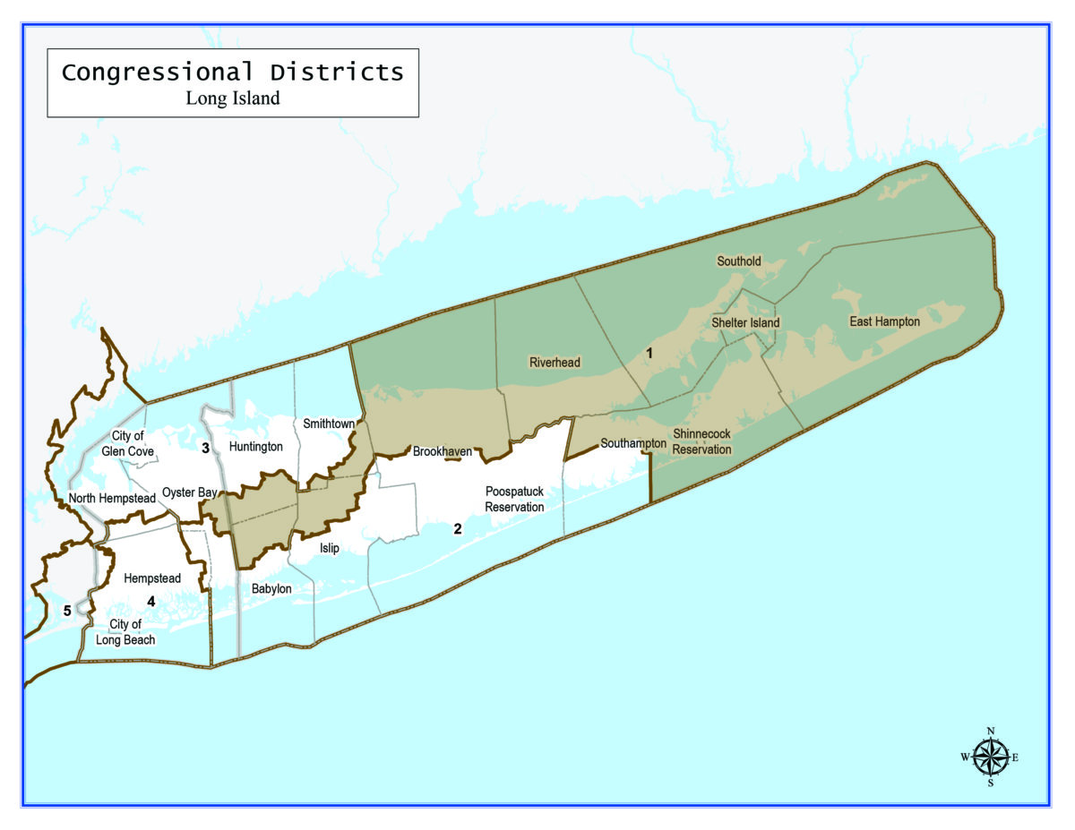
The congressional district that covers the East End would stretch into Nassau County under a map that the New York State Legislature proposed amid the decennial redistricting process that follows the census.
New York’s First Congressional District currently includes all of the five Twin Forks towns and eastern portions of the Town of Brookhaven, including half of Fire Island. Under the proposed new map, southwestern communities in the Town of Southampton were carved out into the Second Congressional District and the First District stretches through parts of the towns of Smithtown, Islip, Babylon, Huntington and — across the county line — a chunk of Oyster Bay.